
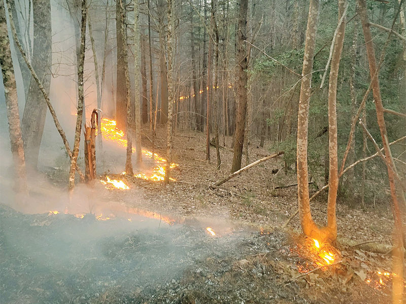
With spring in bloom and warm weather setting in, three state and federal agencies are starting to wind down their prescribed/controlled burn season in the Gilmer-Fannin County area.
The U.S. Forest Service (USFS), Georgia Department of Natural Resources (DNR) and U.S. Army Corps of Engineers have been conducting various prescribed burns across government-controlled woodlands since winter.
Benefits of the man-made ground fires include reducing possible wildfire fuel sources and restoring natural habitat for certain species of native wildlife, noted Steven Bekkerus, of the USFS Chattahoochee-Oconee National Forest district, and Rick Lavender, of the Georgia DNR Wildlife Resources Division.
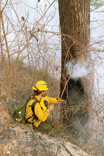 “We typically have a burn season in the fall and one in the spring. It’s something natural we need to do every year in specific locations under controlled conditions. What it does is restore the vegetation to natural habitat, clears out the brush and weeds and dead leaves and allows for new plants that wildlife need to eat to grow,” said Bekkerus. “It also opens up the canopy a bit by getting rid of some of the smaller trees so bigger trees can grow and produce things like acorns and nuts. It’s the little sprout trees (that are burned). We’re trying to eliminate the competition so the bigger trees, which are very well fire adapted, can get more water.”
“The spring burns are growing season burns. They are less frequent (than those in winter), and they have a strong restorative power to them,” added Lavender. “A lot of these habitats used to have fire come across them naturally, and a lot of these species have evolved with that. (Controlled burning) helps wildlife and rare species, different kinds of plants, turkey, deer and things like that.”
Lessening potential fuel sources like brush and leaves is also a step toward reducing the severity of a wildfire if one should break out, Bekkerus noted. Before spring is done, the forest service plans to burn several areas in or near the Cohutta Wilderness, where the Rough Ridge and Rock Mountain fires burned across almost 42,000 acres of National Forest lands in 2016. Areas in or near the Cohuttas where prescribed burning is still to be done include Rocky Flats, the Bob Jones tract and the Chicken Coop Gap mountain pass.
“Hazardous fuel reduction is one of our primary goals,” Bekkerus said. “It’s as much about restoring the habitat and keeping the land and forest healthy, (as it is) controlling the threat of wildfires. Fire is natural, like rain or sunshine, so nature needs a little bit of fire in the right places at the right time under controlled conditions. That way, we don’t get those out of control fires.”
Just recently, the forest service completed prescribed burning of a 465-acre tract in the Rock Creek area just north of Gilmer in Fannin County. Smoke from that particular fire was reported as being smelled in northern Gilmer County near the Fannin line, but that’s something the forest service tries to limit as much as possible.
“We only do a prescribed or controlled burn under certain conditions that have to be just right, and we (actually) have what we call a prescription. It can’t be too windy, but there also can’t be no wind,” Bekkerus said. “We want the smoke to be able to get up and out.”
The first weekend in April was a good example of when not to burn, for both prescribed and other burning activity, Bekkerus noted.
“We actually had (some) wildfires start that weekend because of downed power lines and things like that,” he said.
The Georgia DNR Wildlife Resources Division completed a 218-acre burn of the Rich Mountain Cartecay Tract earlier this year, and the Army Corps of Engineers recently did prescribed burning at the Woodring recreational area of Carters Lake. All three groups work together, sometimes within the same wooded area, during the controlled burn seasons, noted Bekkerus.
“It all depends on who owns the dirt,” he said. “It’s done on rotation. We try to keep them on a three to five year rotation, but it could be anywhere from three to 20 years.”
Lavender said the DNR did a record 75,000 acres of prescribed burning across the state in its 2022 fiscal year and 68,000 acres in the 2021 fiscal year. Much of the controlled burning in Gilmer County is done by the DNR, he noted.
“We normally burn on wildlife management areas and state lands, as well as some state parks. When there’s a burn in a state park, it’s going to be really figured in with their planning about when they have visitation,” Lavender said. “The wildlife conservation and game management (divisions of the DNR) work together (for these) burns.
An upcoming local burn in the Owltown Mountain area near Owltown Creek (off Highway 52 East) will be mostly done by the DNR, but will also involve the forest service on a smaller chunk of land under their management, Lavender noted. It will probably be among the last of such activity in the current burn season.
“Weather and other issues have delayed burns planned for the Rich Mountain Wildlife Management Area and Cartecay Tract Wildlife Management Area, both of which are in Gilmer,” Lavender said. “It’s possible we may still do the burns, but time of year, weather and other factors make that unlikely this season.”
Climate change has caused the prescribed burn seasons to start earlier and earlier each year, Bekkerus noted.
“We typically start in late January or early February, but that depends on the weather. We’re usually done by early May. We don’t like to burn in the summer months because it’s harder for smoke to get out when the wind doesn’t blow as much,” he added. The general public can sign up for burn alerts on the U.S. Forest Service webpage (FS.USDA.gov/main/conf/fire), Bekkerus said.
“We always send out an e-mail before we do a burn. That way, people (who subscribe to the burn alerts) will know it’s a prescribed fire. Or, if we’re not burning, it (may be) a wildfire,” he added.