
-
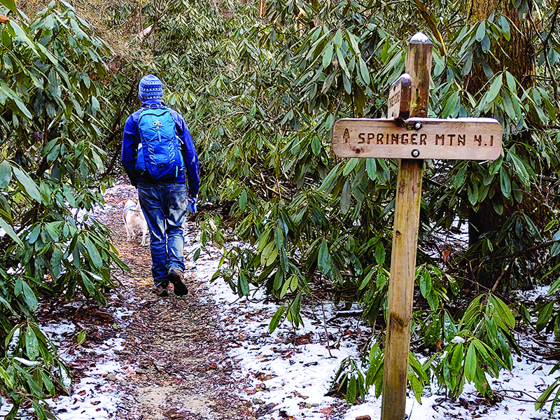 The Appalachian Trail, above, offers some great all-season hiking opportunities near Springer Mountain.
Loop trails are a popular day hiking option because they provide opportunities for exploration without having to retrace one’s steps and cut out the need for figuring out logistics for getting back to a vehicle at the end of the day.
The greater Gilmer area offers a variety of options in this vein for those wanting to get out and stretch their legs in the great outdoors.
Gahuti Trail at Fort Mountain
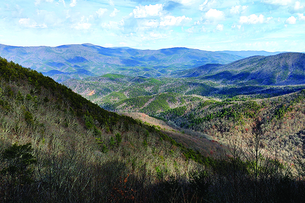
The Gahuti Backcountry Trail is located nearly 18 miles outside of Ellijay in Fort Mountain State Park. Situated in the Chattahoochee National Forest, the recreational area offers a range of hiking opportunities for outdoor enthusiasts to enjoy the mountain scenery.
Named for the Cherokee word for “mother mountain,” the Gahuti is an 8.2-mile loop around the park. The main trailhead is located to the right of the Cool Springs Trail parking area. Allow four to six hours for the entire walk and keep an eye out for wildlife, including deer, songbirds and wild turkey.
Along the route hikers also will encounter the Cool Springs Overlook, a viewing platform offering views to the east and northeast, as well as some more remote points for enjoying views overlooking the Chatsworth area.
There are also four primitive campsites on the Gahuti. A permit and camping fee are required to stay at these camping areas.
A parking fee also applies for entrance to the park.
For more detailed trail information, contact the Fort Mountain visitor center at 706-422-1932.
Bear Creek Loop
Hikers and mountain bikers alike enjoy exploring the Bear Creek Loop Trail. The 6.7-mile trail system is accessible by way of Forest Service Road 241 off Gates Chapel Road west of Ellijay.
The crown jewel of the trail is the Gennett Poplar, located approximately 0.8 miles from the parking area. Measuring nearly 20 feet in circumference, the tulip poplar was spared from the saw by the Gennett Lumber Company in 1955 and left for future generations to enjoy.
The route includes several stream crossings and both single and double track sections for bikers.
The area is also home to a stream-side campground.
Stanley Gap
Loop hikes can also be made by combining portions of different trails, such as this enjoyable hike on the eastern edge of Gilmer County that combines portions of the Stanley Gap and Benton MacKaye trails.
The route can be reached by heading north from Ellijay on Highway 515 and turning right onto Rock Creek Connector in Cherry Log. Then take the next right onto Rock Creek Road and follow this road to the trailhead parking area at the top of Stanley Gap.
Follow the Stanley Gap Trail about half a mile to an intersection with the Benton MacKaye. Be aware that mountain bikers also frequent this area.
While a left at the juncture would take visitors up the ridge to Rocky Mountain, a loop can be completed by taking a right on the Benton MacKaye Trail and heading nearly 1.2 miles downhill to Fall Branch Falls.
After communing with the 60-foot tiered waterfall, visitors can continue following the Benton MacKaye for another half-mile to meet up with Rock Creek Road again. Upon reaching the road, simply take a right and walk back up to the Stanley Gap parking area.
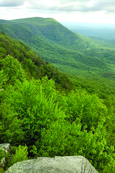
Climb a fire tower
Take a trip to Georgia’s highest lake, learn about local wildlife and visit a fire tower when you undertake this outing.
A 1.2-mile trail loops around Lake Conasauga — located in the Chattahoochee National Forest at elevation 3,150 — and connects to the 1.7 mile Songbird Trail, which includes a loop through a wooded area.
Each of these pathways can also be connected to a 2-mile trail to a fire tower on the summit of Grassy Mountain.
Both the lake and songbird footpaths are relatively flat and the latter is lined with a variety of interpretive signs about avian activity in the area. The trail up to the tower is moderate with steady — but not steep — uphill climbs. The path passes through a wooded area to a gravel fire road that leads to the tower itself.
While the observation platform on the tower is not accessible, hikers can go up the steps to get above the trees for a view. Visitors are urged to exercise caution when both ascending and descending the steps. A climb up the exposed stairway is not for the faint of heart, but the panoramic view at the top of the Cohutta Wilderness is quite worth the adrenaline it takes to get there.
Camping is available first-come, first-served at the Lake Conasauga Campground from mid-April to the end of October.

Springer Mountain and Three Forks loops
Springer Mountain in eastern Gilmer County is the southern terminus for two long-distance footpaths. The Appalachian Trail and Benton MacKaye Trail crisscross one another several times in their first few miles, creating some good loop hiking opportunities. There are two 5-mile loops between Springer and the Three Forks area, which can be hiked separately or strung together for a longer hiking outing.
This region offers a variety of attractive features, including pristine trout streams, towering hemlock trees and long-distance views from atop Springer Mountain and a rock outcropping alongside the Benton MacKaye.
This section of the Appalachian Trail is also home to two hiker shelters — one near the summit of Springer Mountain and the other along Stover Creek.
This series of loops, along with a connected 1.1-mile jaunt from Three Forks to Long Creek Falls also make up the Trout Adventure Trail. Established in 2012 by Blue Ridge Trout Unlimited and the U. S. Forest Service, the 12-mile section of trail is dedicated to raising awareness about local trout and serves as an outdoor classroom exhibiting the importance of healthy habitats and watersheds, as well as conservation.
Parking for these loops is available nine-tenths of a mile from the summit of Springer Mountain on Forest Service 42 and at Three Forks on Forest Service 58.
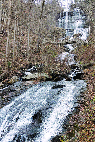
Amicalola Falls State Park
In addition to being home to a waterfall that towers over the surrounding countryside at 729-feet, Amicalola Falls State Park offers a variety of hiking opportunities.
One loop hike is particularly noteworthy because it gives hikers the opportunity to visit a unique lodging experience called the Len Foote Hike Inn. This eco-friendly, backcountry accommodation is only accessible by an easy to moderate 5-mile trail. Those who choose to spend the night at the inn are encouraged to leave technology behind and bask in the serene setting, which is owned by the Georgia Department of Natural Resources and operated by a nonprofit.
Whether hikers plan to stay at the inn or are on a day-hike outing, they can avoid retracing their steps back to the parking area at the state park by continuing on the Hike Inn trail to a juncture with the Approach Trail to the Appalachian Trail. Turning left at the intersection and hiking 4.25 miles south will return visitors to Amicalola Falls.
Parking for both the inn and approach trails is near the top of the falls. A parking fee does apply, and reservations are required for staying at the Hike Inn.
(By Whitney Sherrill, Information Please 2021-22)