


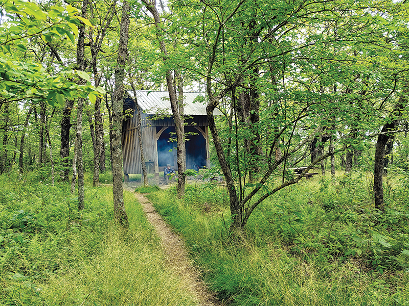
At an elevation of 3,782 feet, Springer Mountain is not Georgia’s tallest peak or its most impressive, but it does hold the distinction of being a place where journeys begin and dreams are fulfilled. The summit, which serves as the southern terminus for the Appalachian Trail (AT), straddles the border of Gilmer and Fannin counties and rises over the expanse of the Chattahoochee National Forest.
 Between Springer and Mount Katahdin in Maine, the AT covers roughly 2,200 miles and passes through 14 states. Georgia is home to about 75 miles of the trail, which is marked by a series of 2 by 6-inch white rectangular blazes painted on trees and rocks along the way.
Springer also serves as the southern terminus for the Benton MacKaye Trail (BMT), which winds nearly 300 miles to the northern edge of Great Smoky Mountains National Park. It is named after a regional planner who conceived the idea for the AT and follows the original route he proposed.
MacKaye pitched the idea for the AT in a journal article published in 1921. He proposed building a series of camps along the spine of the Appalachians in order to give people living in cities on the East Coast a place to escape the toil of everyday life, soak in the mountain air and reconnect with nature. His utopian vision provided an alternative to the growing focus on industrialization following World War I.
The idea for the footpath began to take hold, and before long, volunteers and trail clubs began working with state and federal agencies to make the dream of a long-distance footpath a reality. Construction of the trail took more than 15 years, but it was completed in 1937.
Originally, Mount Oglethorpe in Pickens County served as the southern terminus of the trail, but as large-scale poultry and logging operations developed in the area, the decision was made to move the trailhead to a more remote peak that would be less likely to fall prey to developers. Springer Mountain was chosen in 1958.
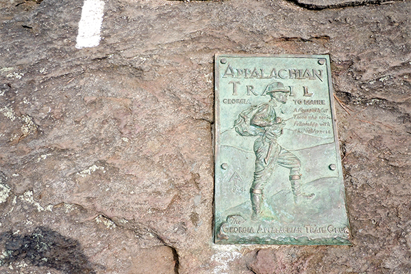
Today, Springer is still an out-of-the-way corner of north Georgia. Those interested in visiting must travel the bumpy, gravel corridor of Forest Service Road 42 and then hike a nearly 1-mile stretch of trail to the summit. Once there, they can see the southernmost blaze of the AT and a plaque designating the trail as “a footpath for those who seek fellowship with the wilderness” (see photo opposite).
Worldwide appeal
While people visit the summit year-round, Springer sees an influx of visitors in the spring at the start of thru-hiker season.
Each year, about 3,000 people set out with the intention of hiking the entire trail — a challenge known as a thru-hike. Most of them start at Springer and head north. As evidenced by a logbook tucked into a crevice of rock on the summit, they come from all over. Just this spring there were entries by folks from Maryland, Portugal, Illinois, Argentina, Florida, New Zealand, Northern Ireland, Colorado and Japan. There was even one entry labeled “From Everywhere.”
For some, just reaching the trail is an adventure in itself. One hiker described riding 500 miles on a freight train and hitchhiking for 350 miles to get from Philadelphia to Springer.
Whether they are between jobs, retired, hoping to commune with nature or, as one entry in a shelter logbook stated, experiencing a “third life crisis,” the thru-hikers have their sights set on the same goal — going the distance.
A thru-hike typically takes four to seven months to complete, and many hikers adopt trail names for the journey, such as Caboose, Troublemaker, Treeslayer, Energizer, Banjo Master, Otter, Pacemaker, Noodles, Grasshopper, Zippy, Better Late Than Never and Lizard of Oz.
 ‘Today I started listening’
When they sign the hiking registry atop Springer, many of the hopeful thru-hikers seem to be pinching themselves to make sure the journey they are embarking on is really happening.
“I can’t believe I’m standing here. I’ve watched so many videos, seen so many pictures, now I’M here,” said Salty from Florida.
Thomas S. added, “I have dreamed of standing on this spot for over 30 years and now I am finally here.”
“The trail has been calling for years. Today I started listening,” observed Wingit.
Atop Springer, some thru-hikers are confident — “Spirits are high. I think I got this,” wrote Nutter Butter — while others, like a hiker from Bavaria, are a little more unsure — “It’s either one day or it’s day one.”
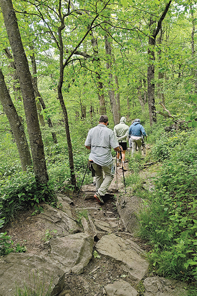
When you consider everything that is involved in hiking up the spine of the Appalachians, it is little wonder that a person might have some uncertainty about if they can rise to the challenge. An expedition on the AT requires hikers to walk day in and day out, carry their supplies on their backs, sleep outdoors, filter water out of mountain streams, cook on portable stoves and adjust to going without many creature comforts.
Many arrive expecting a simple walk in the woods but quickly discover the mountains of north Georgia are far more challenging and rugged than anticipated. Indeed, some would-be thru-hikers who reach the summit of Springer by way of the 8.8-mile AT Approach Trail from Amicalola Falls State Park decide they are through hiking.
The difficulties along the trail are many, and most of the people who attempt to thru-hike the trail will not accomplish their goal. The Appalachian Trail Conservancy estimates that only a fourth of hikers complete the entire journey and warns that a thru-hike is “a grueling and demanding endeavor.”
The organization’s website notes the cumulative elevation gain and loss along the entire length of the trail is the “equivalent to hiking Mt. Everest from sea level and back 16 times.”
“Those who are physically fit may have an edge, especially in the beginning, but ultimately completing the AT is more of a mental challenge. The AT has been hiked by people ranging from age 5 to 86 and by hikers with a wide range of disabilities,” reports the Conservancy.
 The allure of the trail
So why do they do it? Why leave the comforts of home to slog through the woods for months on end? Why put up with the burning muscles, the bugs and the bad weather? Why dodge roots, mud puddles and assorted wildlife? Why drag yourself up sections of trail that make you question the sanity of the person who decided to put the route there?
Referencing a quote derived from the work of Friedrich Nietzsche, one hiker wrote in the registry, “Those who danced were thought to be insane by those who couldn’t hear the music.” It is an apt sentiment to describe someone who has a case of “Springer Fever.”
Some who come to the AT are looking for a way to unplug and unwind. Some want to test themselves against a challenge or to put themselves in a place where there are no obligations, except to put one foot in front of the other and follow the trail as it zigzags up steep slopes, along mercifully flat ridge tops and down rocky hillsides.
“The AT will be my revival to clear my head and set me on a course greater than I can comprehend at this moment,” wrote No Worries.
“[I’m] heading for somewhere between the meaning of life and Virginia” added Greg G., while a man from Lake Park, Ga., observed that his hike was part of “a lifelong search for freedom” and a woman described the hike as “a magical journey with truth and beauty waiting to be unearthed.”
Marcie H. described trekking on the AT as the “adventure of a lifetime,” and Seeker added, “This trip I seek peace of mind and soul … Tomorrow it starts for thru.”
In a 2014 Times-Courier article, AT thru-hiker Collin Chambers described her experience on the trail as “a lifetime condensed into six months.”
For those that finish the trail, standing in victory by the weather-beaten sign marking the summit of Mount Katahdin is not the end of the story.
“The AT stays with you long after you reach the other end of the trail. It’s a journey that lasts a lifetime,” reads a log-book entry from John C., who completed a thru-hike in 2007.
Likewise, most thru-hikers will agree with Chambers when she said, “It’s not about summiting Katahdin, it’s about the journey there.”
A hike on the AT — whether it be for a day or the better part of a year — offers far more than just physical and mental challenges. Those who walk it speak of the friendships made along the trail, breathtaking sunrises, serenity found among wildflowers, cloud-covered ridges, ferny meadows and cascading streams. They remember being surprised by random acts of kindness from strangers known as “trail magic” and of the learning to live each day equipped only with what you can carry.
“What’s the point of having a dream if you don’t try?” said Pearl, and Kathy M. added, “You only live once. Why wait? Why not?”
“It’s worth a shot,” offered Ryan M.
While the majority of thru-hikers are characterized as northbounders, a few individuals decide to tackle the trail by walking south from Maine. Going against the flow, they leave Katahdin in early summer and reach Georgia in the fall. For them, Springer Mountain is the culmination of the journey, and the summit bears witness to a host of their emotions.
As a hiker called Little Engine wrote after an 8 1⁄2 month thru-hike, “After all the pain, cold, sores, sickness, snow, rain, heat, fatigue, sweat, tears, frustrations, bitterness, happiness, wind, loneliness, numbness, etc. … I love this trail, leaving it will break my heart.”
Day hiking opportunities
Of course, the mountain also welcomes plenty of hikers who do not have their sights set on reaching Maine. The gentle uphill climb from the parking lot to the summit is a great outing for families. On any given day at Springer, you are liable to encounter seasoned hikers, couples walking with their dog and kids setting up camp for their first backpacking trip.
Day hikers can enjoy some good loop hiking opportunities since the AT and BMT crisscross one another several times in the first few miles after leaving the top of Springer. There are two 5-mile loops between Springer and the Three Forks area on Forest Service Road 58, which can be hiked separately or strung together for a longer hiking outing.
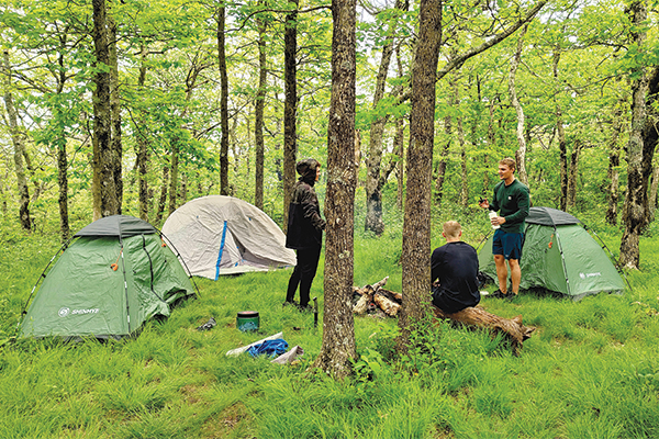
For those looking for an overnight excursion, the area is home to two hiker shelters — one near the summit of Springer Mountain and the other along Stover Creek. Hikers use these rustic, three-sided structures to sleep in or get out of the elements during bad weather. Backpackers can also pitch a tent nearby.
However much of the trail you choose to tackle, take the advice of Kozmk Zian, “(Take things) one day at a time. Don’t try to rush … Have fair skies and be blister free.”
Written by Whitney Sherill for Times-Courier's 2025 Mountain Summer Magazine